

Accuracy. Comprehensiveness. Consistency.
We provide uncompromising discipline in quality, punctual service delivery and affordable prices - cost effective solutions to all your Geospatial needs!
We believe every business - big or small, local, national or international - deserves equal opportunity to our services and equal diligence.
Language should not be a barrier to progress, and hence we work round the clock to provide our services in regional languages as well.
Our growing number of expert members will ensure the best results possible in the most efficient way.
We believe knowledge is a universal right and provide professional training in our field to any number of aspirants through our GeoMinds Workshop initiative.


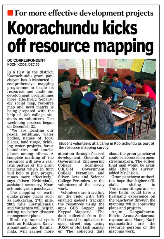
Geominds provided the technical assistance for the participartory mapping held at Koorachundu village panchayat, Kozhikode Dist, Kerala
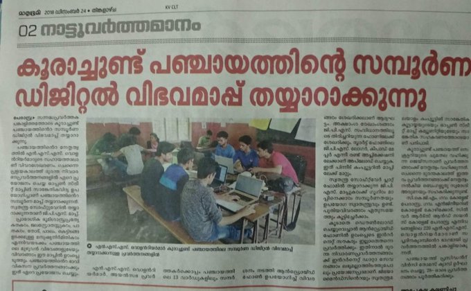
Geominds provided the technical assistance for the participartory mapping held at Koorachundu village panchayat, Kozhikode Dist, Kerala